


Maps of Winfield, Kansas in the 1870's
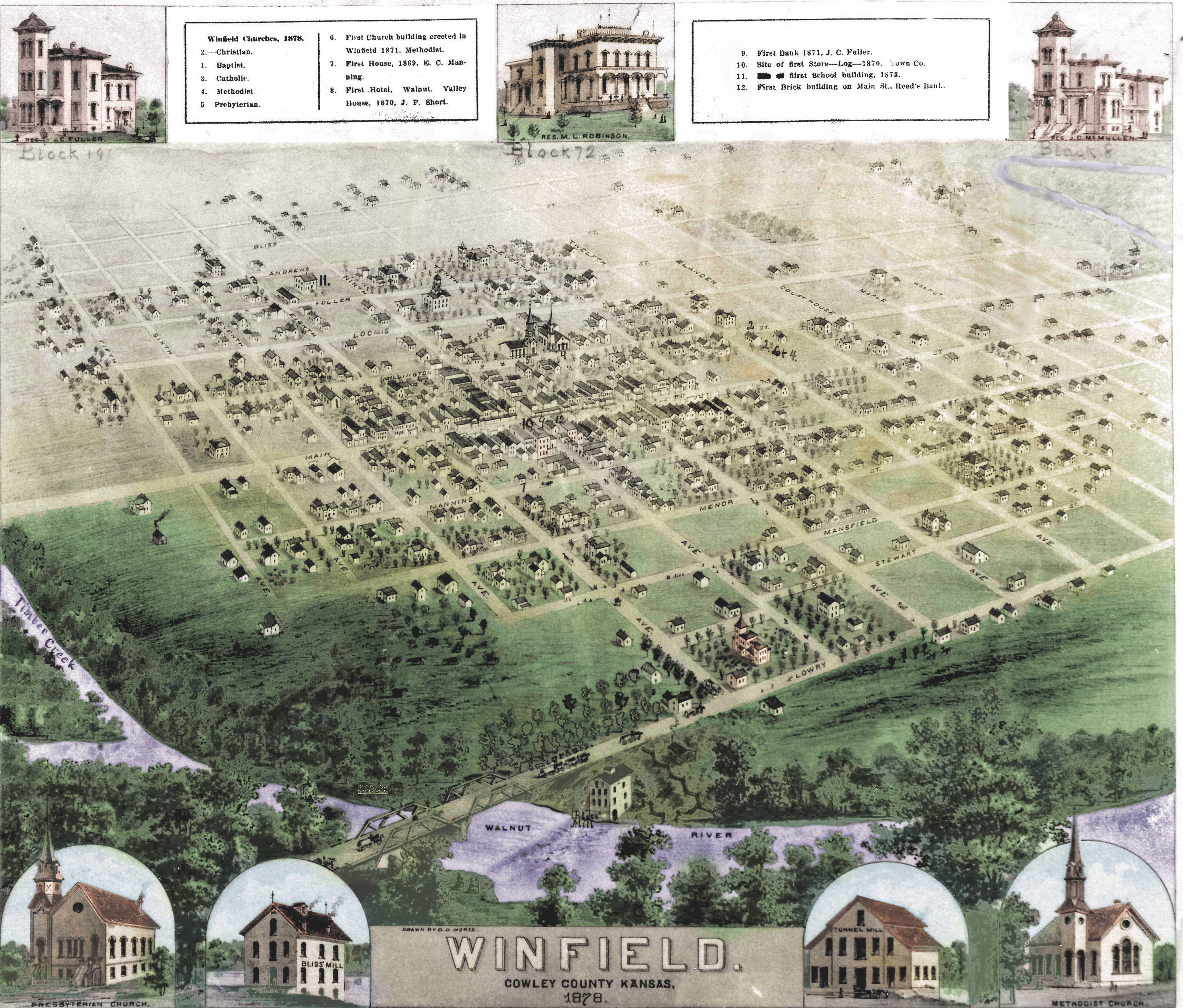
Winfield, Ks in 1878. Photo of original by Rex Flottman
Original Map in the Cowley County Historical Museum, Winfield, Ks.
This map was probably drawn by John Hoenscheidt, architect & surveyor, possibly under contract with the publisher. John Hoenscheidt also drew a detailed Cowley county map and a Winfield map in 1880.
Detail Views
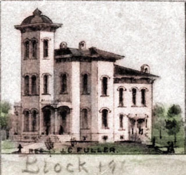
Fuller House
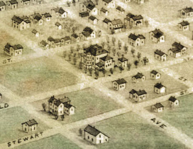
A wider view of the location of the Fuller house at SE corner at Tenth and Fuller
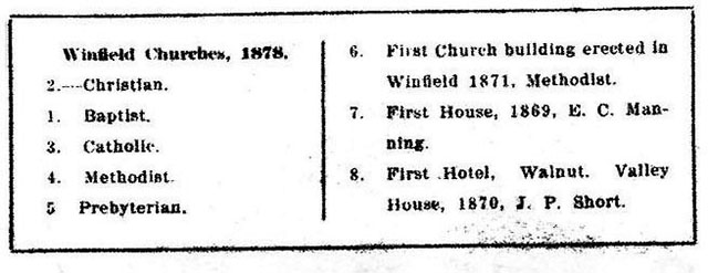
Top Left Legend
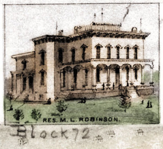
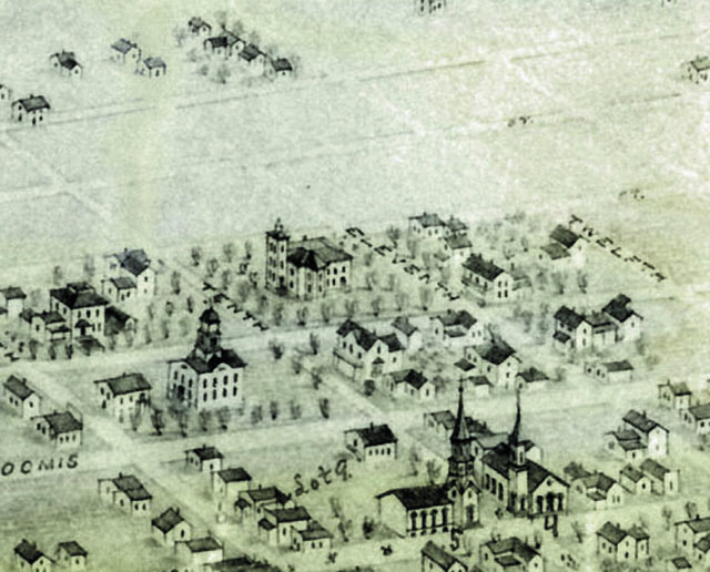
Robinson House
The Robinson House is in the center of this view between 12th and Blanden (13th) and between Menor and Mansfield

Top Right Legend
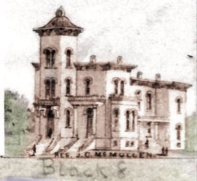
McMullen House
The McMullen/Miller/Hiatt House in 1878
The Residence of J. C. McMullen, later owned by Geo. W. Miller and family (of 101 Ranch fame) and after Mr. Millers death in 1903 by the Hiatt family. Today it is usually referred to as the Hiatt House. This sketch may have been derived from the architects drawing, because this is not the way the house was built.
Kathleen M. Janisse, a descendent of Mr. Mc Mullen writes:
Col. John C. McMullen (a lawyer and banker)apparently admired the design of J.C. Fuller's home and "borrowed" the plans but made it even bigger! The homes do resemble each other and it apparently caused quite a fiasco even back then. This fact is also mentioned in the present day tour brochure on the Homes of Winfield. The Hiatt family apparently added the front curved porch to the home to give it a different facade/look. The J.C. Fuller home was later painted entirely white by another doctor who owned it. A photo of this is at the Cowley Co. Historical Center. This home has since been sandblasted back to its original brick color.
The newspapers during this time compared the cost of Col. J.C.'s home (~$13,000) to the cost of building The Opera House (~$10,000)!! With no railroad available, the supplies had to be brought by wagons. There were several buildings including servant's quarters and a barn. There were ?2 fires where supplies and then buildings were lost.
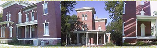
The pictures above were taken in August, 1997 and show that the house was not constructed as the sketch above would indicate. This is probably due to the fact that the house was constructed after the sketch was made.
The birds-eye view of the house places the house a little too far to the left, or north, compared to where it is today. The street on the right is 9th.
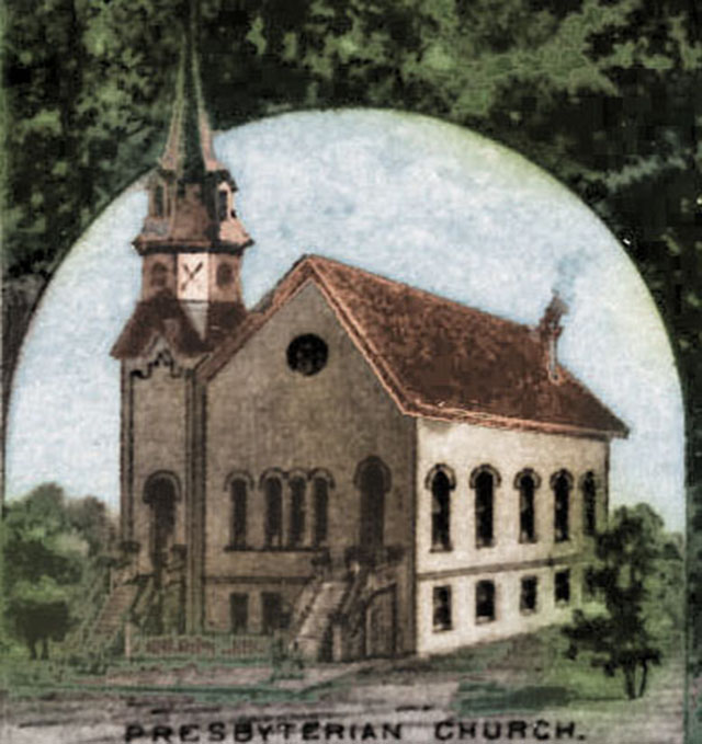
Presbyterian Church
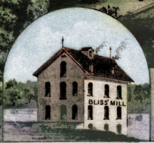
Bliss Mill
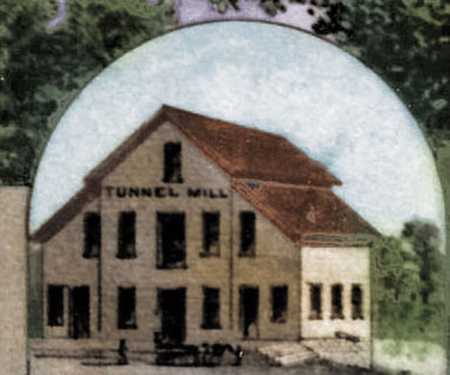
Tunnel Mill
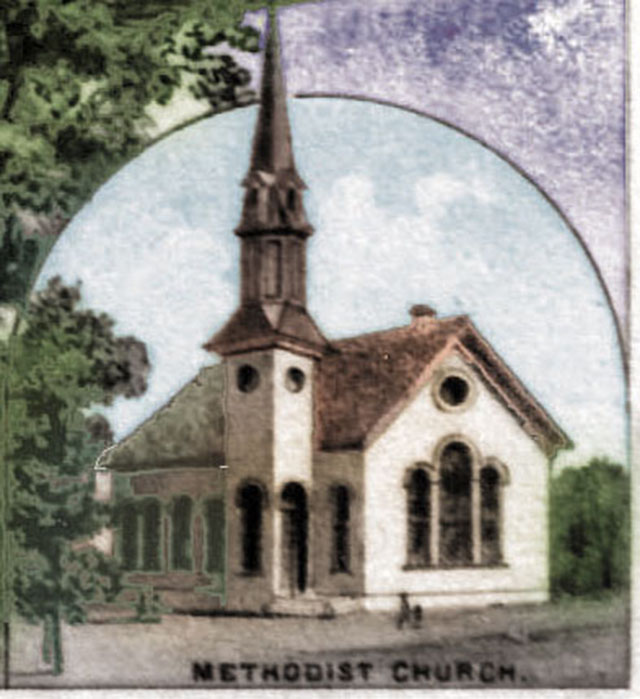
Methodist Church

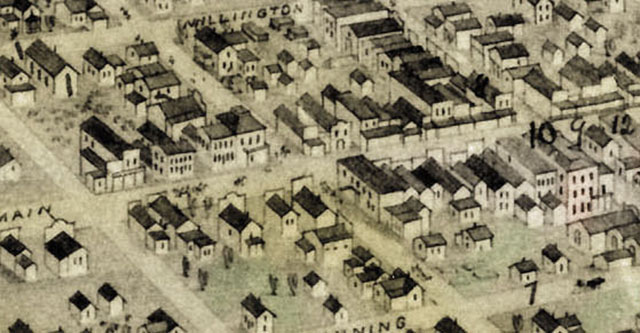
Corner of 9th and Main in 1878
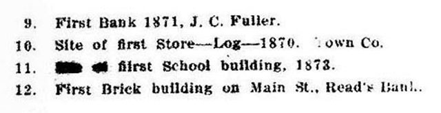
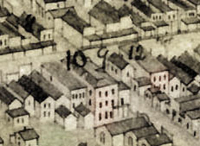
The Northeast corner of the intersection shows buildings 8, 9, 10 and 12, which are, according to the legends above:
8 is the First Hotel in Winfield, the Walnut Valley House, established in 1870 by J. P. Short.
9 is the First Bank in Winfied, established in 1871 by J. C. Fuller.
10 is the location of the First Store which was the "Old Log Store" established in 1870 by the Town Co. of Manning et. al.
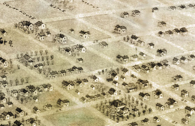
14th and Main
14th Street in Winfield
was Courthouse Street in 1878
Downtown 7th to 9th
Main Street between 7th and 9th
circa 1878
At the right of the picture above the handwritten number 10 indicates the location of the "Old Log Store" on the North West corner of 9th and Main. Manning's house, the first house in Winfield is indicated by the number 7.
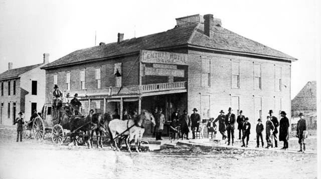
On the North West corner of 8th and Main is the Central Hotel.
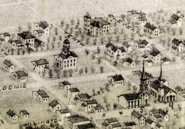
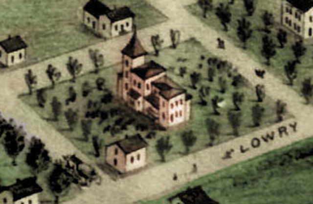
The Court House, Fuller's House, Methodist Church, Presbyterian Church
Circa 1878
Number 4 is the Methodist Church, Number 5 is the Presbyterian Church. The Court House is identifiable in the center of the scene and Fuller's house on above and to the right of the Court House.
Brewrey and Distillery
The building with the smoke coming out looks suspiciously like a distillery. From the old newspapers we know that Frank Manney had a distillary, a brewery and an orchard, and they were near the river on the north side of town.
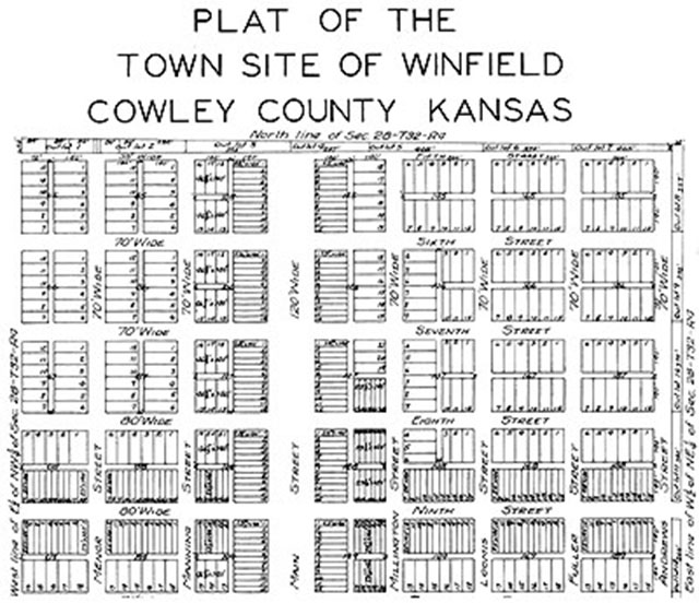
Plat Map of the Town site of Winfield 1872
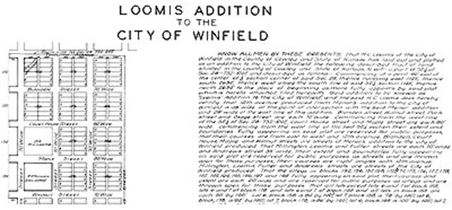
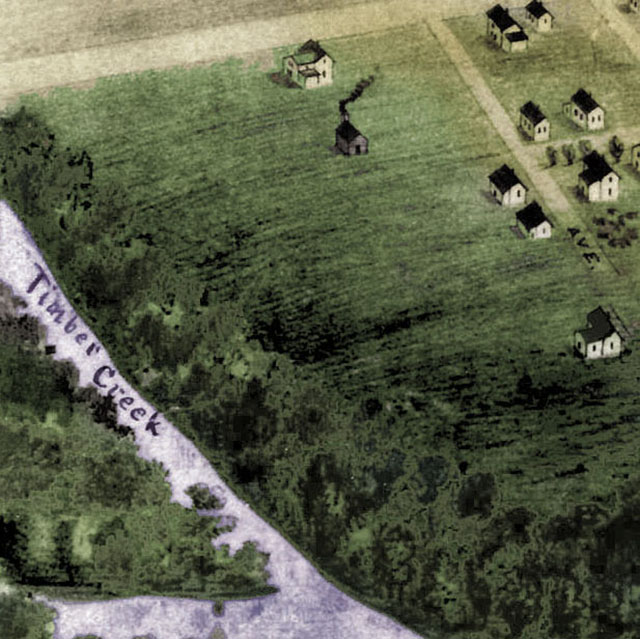
Loomis Addition to the City of Winfield 1878
